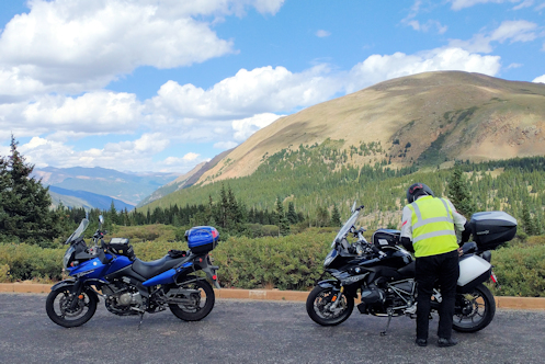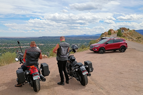
On top of Skyline Drive.
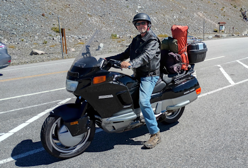
Nick and I headed out on a four-day clock-wise loop ride through Colorado, getting on the road about 9 a.m. We headed out US 285 up to Pine Junction and then turned south. Our first stop of the day was at Deckers. There were maybe 8 other bikes there at the time but in less than five minutes another dozen or so came pouring in. Looked like a good day to ride.
We were set up with Cardo communicators and on the “Public” frequency so we were curious if we’d pick up anyone else’s conversation but we did not. There were a bunch of Cardos on those helmets, though.
We continued south to Woodland Park, passing through the burn area of the Hayman Fire 25 years ago. For the first time I noticed the new growth finally looking like it was really getting established. So 25 years to come back from the fire.
At Woodland Park we turned west to Divide, then south to Cripple Creek. Just a very few aspens starting to turn color at this point. Our interest was not in Cripple Creek itself, though I’m sure Nick was interested to see the place because it is pretty picturesque, but we really just wanted to go through it and on south further. That’s a really nice ride in case you’ve never done it.
As we hooked up with CO 9 and then US 50 we headed on into Canon City. My first eye-opener of the trip for Nick was Skyline Drive. He was not expecting it and was a bit unsure, telling me he found it “slightly unnerving.” Guardrails? I don’t need no stinkin’ guardrails.
After lunch in Canon City we continued to Florence, then south on CO 67. Now we were getting into an area I have certainly been through numerous times but where I am not totally acquainted with all the roads. I had looked at the map beforehand but that’s not always enough. We got to where 67 meets CO 96 and I took the right. I believed this was the correct route but Nick is one of those guy who has every gadget and he was looking at his GPS. We were headed for Walsenburg that day and his GPS was telling him to go the other way.
We cruised a bit–me unsure and him arguing for the other direction–and eventually we turned back. We got past where we had gotten on this road, went further, and the terrain was not looking like mountains at all, it was looking like the prairie. I asked Nick where his GPS showed this road taking us and he said straight to Pueblo. Pueblo?! No! We do not want to go to Pueblo. We stopped and I checked the map and sure enough, I was right in the first place. So we turned around again, riding one particular stretch of this road for the third time. Good thing we’re not going far today.
Following 96 south we got behind a guy in a pick-up who was going slow. And he kept going slower. And slower. Nick offered that he was probably slowing down to let us get past him. That was fine, and courteous of him, but we were in a stretch full of blind curves. I don’t care how slow you’re going, I’m not passing you on a blind curve. We finally did get around him, and then turned south again on CO 165.
The next eye-opener of the trip came up soon enough, Bishop Castle. Nick handles his bike well at speed but he is one of those folks who absolutely hate gravel. That’s one thing that made our turning around and turning around again particularly troublesome because he insisted on doing so on pavement–and pavement wasn’t necessarily available in those places. I told him he had no choice, we were stopping here and there was no pavement. But I picked a spot where we could pull right off the road, arc around, and stop with our noses to the road just a couple feet away. He didn’t like it but he went along with me.
Nick perplexed me several times on this ride. We walked up to Bishop Castle but being an Easterner (Chicago) he was feeling the altitude and had no inclination to go in the castle or climb up into any of the turrets. Instead, he pulled out his phone and spent 10 minutes reading about . . . the Hayman Fire. I finally slapped him on the shoulder and asked, “We’re standing at the base of Bishop Castle. Why are you reading about the Hayman Fire?” His response: “I’m just compulsive.”
Heading out from Bishop Castle we did not check first to see that our communicators were talking to each other and it turned out they weren’t. No matter, we don’t have far to go and we both know where we’re going.
Good thing because coming into Colorado City there is a turn-off, a short-cut, that takes you to join I-25 further south. But it is not well marked. I went past it but with no communicators Nick could not tell me that his GPS was saying to take this turn. I saw him waving in my mirror and turning so I went back, expecting to find him waiting for me there. He was not.
I didn’t know for certain this was where he turned so I checked Google Maps. Google Maps told me the cut-off was a little further back so I went there. Turned down this road and it quickly became gravel. This was the second of three times recently when Google Maps has sent me on wild goose chases. I turned around again and this time just headed on into Colorado City and I-25.
I blasted south on I-25, got to Walsenburg, and the motel was right there. Nick was in the lobby but informed me they did not have a reservation for tonight under my name. What? It turns out I screwed up making the reservation and booked it for a week later. Fortunately the lady at the desk was able to straighten it all out and we got our room.
OK, first day is in the books. We had our share of screw-ups. But hey, we’re out riding.
Biker Quote for Today
You might be a Yuppie biker if the only time you’ve thrown up is when you’ve had the flu or just had too many veggie fajitas.